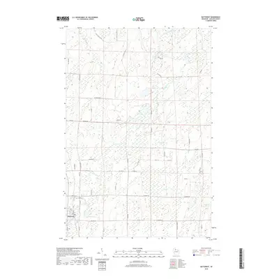
2018 Map of Butternut
USGS Topo · Published 2018About this map
Butternut sits at the southwestern edge of this landscape, serving as a gateway to a glaciated region defined by its numerous small lakes and wetlands. The drainage of Butternut Cr and its northern reaches near Little Butternut Lake influence the terrain, while the E Fork Chippewa River cuts through the northeast corner. Cultural markers such as Union Cem and a dense network of fire lanes and local roads like Masterson Fire Ln and Pine Plantation Rd reflect a history of timber management and rural development. The area's character is shaped by names like Parker Lake, Lindbergh Lake, and Blueberry Lake, which represent the natural focal points of the Ashland County backcountry.
Find a feature on this map
54 named features on this map. Tap any name to fly to it.
Don’t see what you’re looking for? This feature index may not catch every label — zoom into the map to look around manually.
Map Details
Editions of this 2018 Butternut Map
This is the sole edition of this map. No revisions or reprints were ever made.
Other maps of this area

1940 · Butternut
USGS Topo · 1:48,000

1941 · Park Falls
USGS Topo · 1:48,000

1941 · Kennedy
USGS Topo · 1:48,000

1942 · Glidden
USGS Topo · 1:48,000

1943 · Park Falls
USGS Topo · 1:48,000

1945 · Kennedy
USGS Topo · 1:48,000

1945 · Glidden
USGS Topo · 1:48,000

1947 · Park Falls
USGS Topo · 1:48,000

1947 · Butternut
USGS Topo · 1:48,000

1950 · Butternut
USGS Topo · 1:48,000