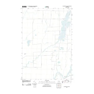
2010 Map of Butternut Lake
USGS Topo · Published 2010About this map
Butternut Lake dominates this northern Wisconsin landscape, appearing as a sprawling waterway fed by Spiller Creek and connected to smaller basins like Mud Lake and Schnur Lake. The geography is defined by a dense network of glacial water bodies and meandering streams, including the southern flow of the Flambeau River near the Pixley WP61 Dam. This 2010 survey illustrates the transition from the lake-studded north to the river-drained south, where Butternut Creek and Beaver Creek cut through the terrain. Evidence of local industry and infrastructure is found at the Mill Pond and the Kennedy Lookout Tower situated near the western edge. The map also traces a grid of rural routes such as County Hwy-B and Bass Lake Rd, providing a clear view of the property divisions and access points that define this recreation-rich pocket of Ashland County.
Find a feature on this map
46 named features on this map. Tap any name to fly to it.
Don’t see what you’re looking for? This feature index may not catch every label — zoom into the map to look around manually.
Map Details
Editions of this 2010 Butternut Lake Map
This is the sole edition of this map. No revisions or reprints were ever made.
Other maps of this area

1940 · Butternut
USGS Topo · 1:48,000

1941 · Park Falls
USGS Topo · 1:48,000

1941 · Kennedy
USGS Topo · 1:48,000

1942 · Glidden
USGS Topo · 1:48,000

1943 · Park Falls
USGS Topo · 1:48,000

1945 · Kennedy
USGS Topo · 1:48,000

1945 · Glidden
USGS Topo · 1:48,000

1947 · Park Falls
USGS Topo · 1:48,000

1947 · Butternut
USGS Topo · 1:48,000

1950 · Butternut
USGS Topo · 1:48,000