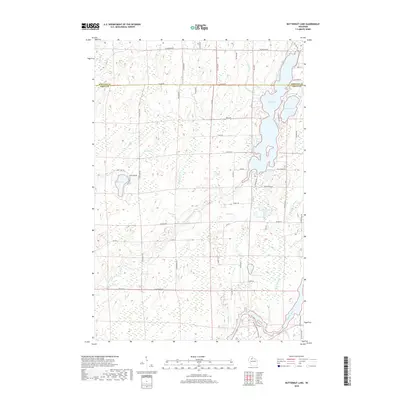
2018 Map of Butternut Lake
USGS Topo · Published 2018About this map
Butternut Lake and its surrounding wetlands dominate this 2018 survey of the borderlands between Ashland and Price counties. The map traces the intricate hydrography of the region, where Butternut Creek and Riley Cr navigate a landscape dense with small water bodies like Schnur Lake and Buckman Lake. The south-central portion of the quadrangle is marked by the Mill Pond, while the Flambeau River cuts through the southeastern corner, reflecting the importance of these waterways to the area's geography.
Find a feature on this map
59 named features on this map. Tap any name to fly to it.
Don’t see what you’re looking for? This feature index may not catch every label — zoom into the map to look around manually.
Map Details
Editions of this 2018 Butternut Lake Map
This is the sole edition of this map. No revisions or reprints were ever made.
Other maps of this area

1940 · Butternut
USGS Topo · 1:48,000

1941 · Park Falls
USGS Topo · 1:48,000

1941 · Kennedy
USGS Topo · 1:48,000

1942 · Glidden
USGS Topo · 1:48,000

1943 · Park Falls
USGS Topo · 1:48,000

1945 · Kennedy
USGS Topo · 1:48,000

1945 · Glidden
USGS Topo · 1:48,000

1947 · Park Falls
USGS Topo · 1:48,000

1947 · Butternut
USGS Topo · 1:48,000

1950 · Butternut
USGS Topo · 1:48,000