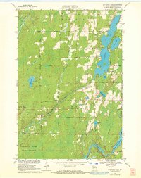
1970 Map of Butternut Lake
USGS Topo · Published 1972About this map
Butternut Lake dominates the eastern half of this landscape, its shoreline traced by Lakeshore Drive and dotted with numerous gravel pits. The 1970 landscape is defined by the heavy presence of the Flambeau River State Forest in the south, where the Flambeau River reaches the Pixley Dam to form the Pixley Flowage. Throughout the central timberlands, a network of local roads such as Maple Ridge Road and Kaiser Road connect small water bodies like Buckman Lake and Cooley Lake. The map reveals the industrial and navigational history of the area through the presence of the Chicago and North Western rail line and the Kennedy Lookout Tower standing sentinel over the northern heights. A dense network of tributaries, including Timm Creek and Beaver Creek, feed into the larger river systems, illustrating the complex drainage of the northern woods.
Find a feature on this map
40 named features on this map. Tap any name to fly to it.
Don’t see what you’re looking for? This feature index may not catch every label — zoom into the map to look around manually.
Map Details
Editions of this 1970 Butternut Lake Map
This is the sole edition of this map. No revisions or reprints were ever made.
Other maps of this area

1940 · Butternut
USGS Topo · 1:48,000

1941 · Park Falls
USGS Topo · 1:48,000

1941 · Kennedy
USGS Topo · 1:48,000

1942 · Glidden
USGS Topo · 1:48,000

1943 · Park Falls
USGS Topo · 1:48,000

1945 · Kennedy
USGS Topo · 1:48,000

1945 · Glidden
USGS Topo · 1:48,000

1947 · Park Falls
USGS Topo · 1:48,000

1947 · Butternut
USGS Topo · 1:48,000

1950 · Butternut
USGS Topo · 1:48,000