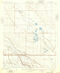
1932 Map of Buttonwillow
USGS Topo · Published 1932About this map
Buttonwillow and the surrounding Kern County landscape appear here as a highly organized agricultural and industrial corridor during the late 1920s. The dominance of large-scale land holdings is evident through the presence of the Miller and Lux Headquarters Ranch, alongside other prominent family-named operations like Palomas Ranch and Elk Grove Ranch. The Southern Pacific railroad line runs parallel to the MC Kittrick Bakersfield Highway, serving as the primary artery for moving cattle and crops from this productive valley floor.
Find a feature on this map
25 named features on this map. Tap any name to fly to it.
Don’t see what you’re looking for? This feature index may not catch every label — zoom into the map to look around manually.
Map Details
Editions of this 1932 Buttonwillow Map
3 editions found
Other maps of this area

1910 · Buena Vista Lake
USGS Topo · 1:125,000

1912 · McKittrick
USGS Topo · 1:125,000

1912 · Buena Vista Lake
USGS Topo · 1:125,000

1914 · Lost Hills
USGS Topo · 1:125,000

1927 · Semitropic
USGS Topo · 1:31,680

1929 · Coles Levee
USGS Topo · 1:31,680

1930 · Leonards
USGS Topo · 1:31,680

1930 · Wasco
USGS Topo · 1:31,680

1931 · Rio Bravo
USGS Topo · 1:31,680

1931 · Lokern
USGS Topo · 1:31,680