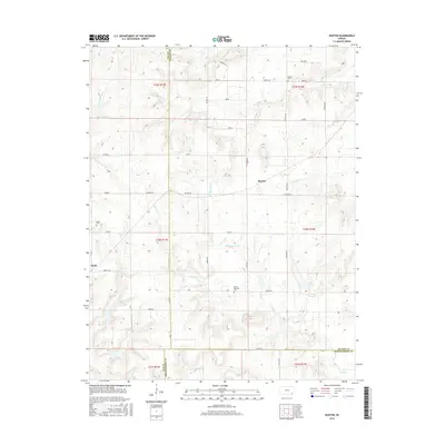
2016 Map of Buxton
USGS Topo · Published 2016About this map
Upola and the nearby Buxton settlement anchor this rural landscape in southeastern Kansas, situated at the intersection of Elk, Wilson, and Montgomery counties. The area is defined by a dendritic network of streams, including E Rainbow Cr and W Rainbow Cr in the north and the meandering Bachelor Cr to the south. Small, family-named burial grounds like Butner Cem, Upola Cem, and Mount Pleasant Cem are scattered across the section lines, providing critical points of reference for genealogists and local historians. A strict grid of section roads, such as Buxton Rd and Chase Rd, facilitates movement through the agricultural terrain, while numerous smaller waterways like Middle Duck Cr and S Duck Cr carve out the local topography. This layout reflects the enduring pattern of Midwestern township and range surveying, where the landscape remains dedicated to farming and sparse residential nodes.
Find a feature on this map
43 named features on this map. Tap any name to fly to it.
Don’t see what you’re looking for? This feature index may not catch every label — zoom into the map to look around manually.
Map Details
Editions of this 2016 Buxton Map
This is the sole edition of this map. No revisions or reprints were ever made.
Other maps of this area

1885 · Eureka
USGS Topo · 1:125,000

1885 · Sedan
USGS Topo · 1:125,000

1886 · Fredonia
USGS Topo · 1:125,000

1886 · Independence
USGS Topo · 1:125,000

1888 · Eureka
USGS Topo · 1:125,000

1889 · Sedan
USGS Topo · 1:125,000

1894 · Fredonia
USGS Topo · 1:125,000

1894 · Independence
USGS Topo · 1:125,000

1894 · Eureka
USGS Topo · 1:125,000

1905 · Independence
USGS Topo · 1:125,000