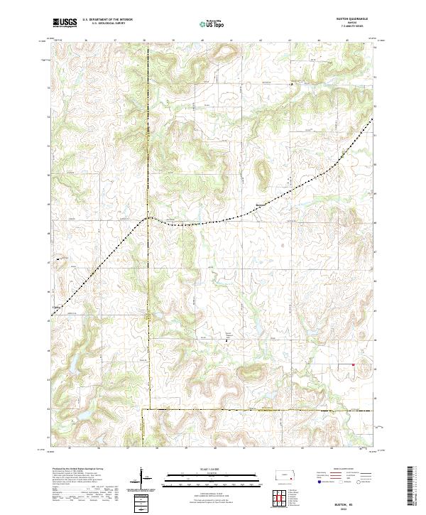
2022 Map of Buxton
USGS Topo · Published 2022About this map
The small settlement of Buxton sits at the junction of Chase Rd and Buxton Rd, serving as a central point in this rural landscape at the border of Wilson and Elk counties. To the west, the community of Upola is situated near Upola Cem and Hickory Cr, highlighting the quiet residential and agricultural history of the region. The terrain is defined by an intricate network of waterways, including the various branches of Duck Cr and the divided flows of W Rainbow Cr and E Rainbow Cr.
Find a feature on this map
48 named features on this map. Tap any name to fly to it.
Don’t see what you’re looking for? This feature index may not catch every label — zoom into the map to look around manually.
Map Details
Editions of this 2022 Buxton Map
This is the sole edition of this map. No revisions or reprints were ever made.
Other maps of this area

1885 · Eureka
USGS Topo · 1:125,000

1885 · Sedan
USGS Topo · 1:125,000

1886 · Fredonia
USGS Topo · 1:125,000

1886 · Independence
USGS Topo · 1:125,000

1888 · Eureka
USGS Topo · 1:125,000

1889 · Sedan
USGS Topo · 1:125,000

1894 · Fredonia
USGS Topo · 1:125,000

1894 · Independence
USGS Topo · 1:125,000

1894 · Eureka
USGS Topo · 1:125,000

1905 · Independence
USGS Topo · 1:125,000