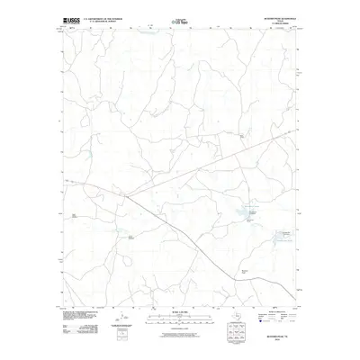
2010 Map of Buzzard Peak
USGS Topo · Published 2010About this map
Buzzard Peak rises over the high plains of King County, overlooking a landscape defined by ranching operations and essential water sources. This portion of North Texas is characterized by wide-reaching drainage systems, including the South Wichita River at the northern boundary and the meandering paths of Dikes Creek, Spring Creek, and Little Croton Creek. The map illustrates the infrastructure of the local cattle industry, marking the locations of the Moorhouse Ranch and Ross Ranch, along with specialized landmarks like the Upper Blakey Windmill and Lower Blakey Windmill. Water management is prominent through features such as Moorhouse Lake and the Snake Den Tank, both of which are supported by small-scale dams like the Moorhouse Lake Dam. The reliance on these reservoirs and windmills highlights the practical adaptations required for livestock in this semi-arid environment.
Find a feature on this map
16 named features on this map. Tap any name to fly to it.
Don’t see what you’re looking for? This feature index may not catch every label — zoom into the map to look around manually.
Map Details
Editions of this 2010 Buzzard Peak Map
This is the sole edition of this map. No revisions or reprints were ever made.
Other maps of this area

1954 · Lubbock
USGS Topo · 1:250,000

1954 · Wichita Falls
USGS Topo · 1:250,000

1958 · Wichita Falls
USGS Topo · 1:250,000

1966 · Ox Yoke Creek
USGS Topo · 1:24,000

1966 · J Y Ranch
USGS Topo · 1:24,000

1966 · Maverick Flat
USGS Topo · 1:24,000

1967 · Cedar Mountain
USGS Topo · 1:24,000

1967 · Dark Canyon
USGS Topo · 1:24,000

1967 · Knox City NW
USGS Topo · 1:24,000

1967 · Kiowa Peak NW
USGS Topo · 1:24,000