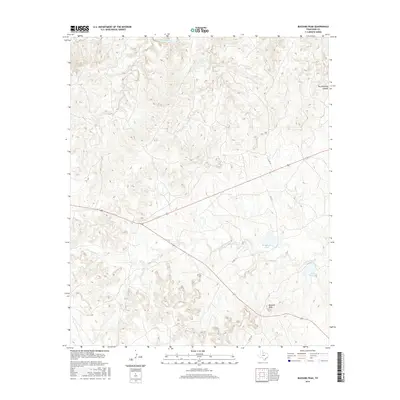
2016 Map of Buzzard Peak
USGS Topo · Published 2016About this map
Buzzard Peak anchors the southeastern landscape of this King County survey, rising above a network of canyons and watercourses that define the region's cattle-country character. The northern reaches are bounded by the South Wichita River, which carves through the terrain alongside significant drainage systems like Dikes Cr and Spring Cr. Ranching infrastructure is evident through the naming of water sources such as Snake Den Tank and the presence of Moorhouse Lake, reflecting the essential need for water management in this arid part of North Texas. Transport through this sparse territory is facilitated by State Highways 82, 114, and 222, which intersect near the center of the sheet. The map provides a clear view of the deep topographic relief at Big Getaway Canyon and the numerous smaller tributaries of Little Croton Cr that weave through the broken ground.
Find a feature on this map
14 named features on this map. Tap any name to fly to it.
Don’t see what you’re looking for? This feature index may not catch every label — zoom into the map to look around manually.
Map Details
Editions of this 2016 Buzzard Peak Map
This is the sole edition of this map. No revisions or reprints were ever made.
Other maps of this area

1954 · Lubbock
USGS Topo · 1:250,000

1954 · Wichita Falls
USGS Topo · 1:250,000

1958 · Wichita Falls
USGS Topo · 1:250,000

1966 · Ox Yoke Creek
USGS Topo · 1:24,000

1966 · J Y Ranch
USGS Topo · 1:24,000

1966 · Maverick Flat
USGS Topo · 1:24,000

1967 · Cedar Mountain
USGS Topo · 1:24,000

1967 · Dark Canyon
USGS Topo · 1:24,000

1967 · Knox City NW
USGS Topo · 1:24,000

1967 · Kiowa Peak NW
USGS Topo · 1:24,000