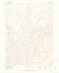
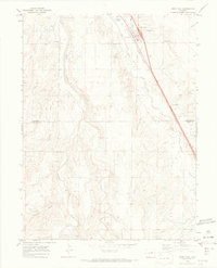
1969 Map of Byers SW
USGS Topo · Published 1973About this map
West Bijou Cr and its network of ephemeral drainages define this high plains landscape at the border of Arapahoe and Elbert counties. In the late 1960s, the area was characterized by wide-open grazing land and a developing infrastructure for resource extraction, evidenced by various Gravel Pits and scattered wells. The topography is marked by significant erosion patterns, with named features like Rattlesnake Creek and Mule Gulch carving distinct paths through the terrain. Human activity is largely concentrated along transit corridors like Exmore Road and Ridge Road, alongside a prominent Pipeline that traverses the southern half of the quadrangle. For the researcher, the map preserves the exact locations of isolated infrastructure, including a Drill Hole and specific water tanks, which reveal the scattered nature of rural development during this era.
Find a feature on this map
14 named features on this map. Tap any name to fly to it.
Don’t see what you’re looking for? This feature index may not catch every label — zoom into the map to look around manually.
Map Details
Editions of this 1969 Byers SW Map
3 editions found
Other maps of this area

1953 · Denver
USGS Topo · 1:250,000

1955 · Strasburg
USGS Topo · 1:24,000

1956 · Peoria
USGS Topo · 1:24,000

1956 · Byers
USGS Topo · 1:24,000

1957 · Denver
USGS Topo · 1:250,000

1958 · Denver
USGS Topo · 1:250,000

1960 · Denver
USGS Topo · 1:250,000

1968 · Deer Trail
USGS Topo · 1:24,000
1969 · Strasburg SE
USGS Topo · 1:24,000
1969 · Deer Trail
USGS Topo · 1:24,000