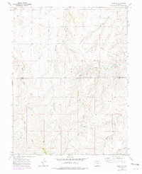
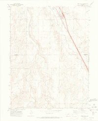
1969 Map of Byers SW
USGS Topo · Published 1979About this map
Rattlesnake Creek and Hay Gulch define the drainage patterns of this High Plains landscape as it appeared during the late 1960s. The topography is marked by a series of parallel ridges and valleys, where agricultural and ranching infrastructure like a Water Tank and numerous wells are essential features of the rural economy. Human activity in the area is further evidenced by a prominent Pipeline that traverses the terrain and extraction sites such as a Gravel Pit.
Find a feature on this map
13 named features on this map. Tap any name to fly to it.
Don’t see what you’re looking for? This feature index may not catch every label — zoom into the map to look around manually.
Map Details
Editions of this 1969 Byers SW Map
3 editions found
Other maps of this area

1953 · Denver
USGS Topo · 1:250,000

1955 · Strasburg
USGS Topo · 1:24,000

1956 · Peoria
USGS Topo · 1:24,000

1956 · Byers
USGS Topo · 1:24,000

1957 · Denver
USGS Topo · 1:250,000

1958 · Denver
USGS Topo · 1:250,000

1960 · Denver
USGS Topo · 1:250,000

1968 · Deer Trail
USGS Topo · 1:24,000
1969 · Strasburg SE
USGS Topo · 1:24,000
1969 · Deer Trail
USGS Topo · 1:24,000