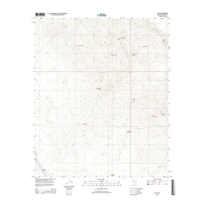
2014 Map of Bylas
USGS Topo · Published 2014About this map
The settlement of Bylas sits at the southwestern edge of this landscape, situated along the Gila River and the corridor of Us-70. The terrain is defined by the high elevations of the Gila Mountains, where numerous canyons and peaks create a complex network of drainages. Local landmarks such as China Peak, Diamond Bar Peak, and McKinney Mtn punctuate the high ground, while the interior is marked by named canyons like Grapevine Canyon, Yellowjacket Canyon, and Steer Springs Canyon.
Find a feature on this map
37 named features on this map. Tap any name to fly to it.
Don’t see what you’re looking for? This feature index may not catch every label — zoom into the map to look around manually.
Map Details
Editions of this 2014 Bylas Map
This is the sole edition of this map. No revisions or reprints were ever made.
Other maps of this area

1954 · Clifton
USGS Topo · 1:250,000

1954 · Mesa
USGS Topo · 1:250,000

1957 · Mesa
USGS Topo · 1:250,000

1957 · Clifton
USGS Topo · 1:250,000

1958 · Clifton
USGS Topo · 1:250,000

1958 · Mesa
USGS Topo · 1:250,000

1960 · Mesa
USGS Topo · 1:250,000

1960 · Bylas
USGS Topo · 1:62,500

1960 · Fort Thomas
USGS Topo · 1:62,500

1962 · Clifton
USGS Topo · 1:250,000