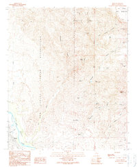
1989 Map of Bylas
USGS Topo · Published 1990About this map
The settlement of Bylas serves as the focal point of this arid river valley landscape, situated along the Gila River within the San Carlos Indian Reservation. The terrain is defined by a series of deep canyons and peaks that rise sharply from the valley floor, including McKinney Mountain and Diamond Peak. This late-20th-century survey highlights a complex network of water management features essential for life in the high desert, such as the Sampson Windmill and various cattle tanks like Upper McKinney Tank and Jim Barth Tank.
Find a feature on this map
40 named features on this map. Tap any name to fly to it.
Don’t see what you’re looking for? This feature index may not catch every label — zoom into the map to look around manually.
Map Details
Editions of this 1989 Bylas Map
This is the sole edition of this map. No revisions or reprints were ever made.
Other maps of this area

1954 · Clifton
USGS Topo · 1:250,000

1954 · Mesa
USGS Topo · 1:250,000

1957 · Mesa
USGS Topo · 1:250,000

1957 · Clifton
USGS Topo · 1:250,000

1958 · Clifton
USGS Topo · 1:250,000

1958 · Mesa
USGS Topo · 1:250,000

1960 · Mesa
USGS Topo · 1:250,000

1960 · Bylas
USGS Topo · 1:62,500

1960 · Fort Thomas
USGS Topo · 1:62,500

1962 · Clifton
USGS Topo · 1:250,000