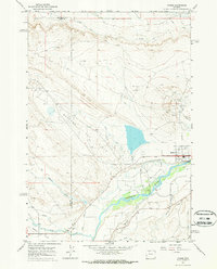
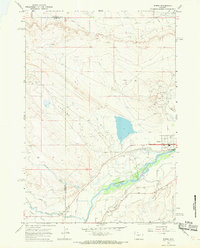
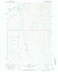
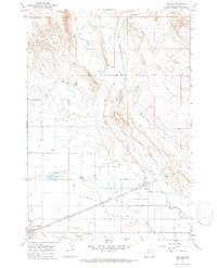
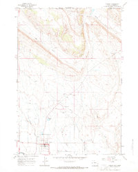
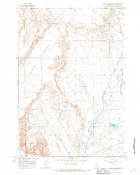
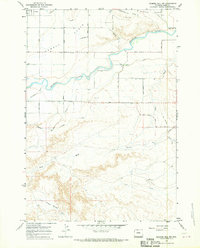
1967 Map of Byron
USGS Topo · Published 1970About this map
The Shoshone River flows through this Bighorn Basin landscape, which is defined by a sophisticated network of irrigation and petroleum extraction. By the late 1960s, the engineering of the Sidon Canal and Elk Lovell Canal supported agricultural life on Powell Flats, while the Garland Oil Field and Byron Oil Field highlight the region's industrial foundation. Numerous oil wells and drill holes are scattered across the terrain, indicating the density of the local energy economy. The town of Byron serves as the primary hub, containing local landmarks such as Memorial Park and the Byron Cemetery. Further south, the map identifies Mantua and the drainage of Mantua Draw and Bitter Creek. This survey captures the transition between the irrigated valley floor and the arid, resource-rich uplands during a period of steady production.
Find a feature on this map
27 named features on this map. Tap any name to fly to it.
Don’t see what you’re looking for? This feature index may not catch every label — zoom into the map to look around manually.
Map Details
Editions of this 1967 Byron Map
2 editions found
Other maps of this area

1955 · Cody
USGS Topo · 1:250,000

1958 · Cody
USGS Topo · 1:250,000

1962 · Cody
USGS Topo · 1:250,000
1966 · Gilmore Hill NE
USGS Topo · 1:24,000
1966 · Frannie
USGS Topo · 1:24,000
1966 · Garland
USGS Topo · 1:24,000
1966 · Cowley
USGS Topo · 1:24,000
1966 · Deaver Reservoir
USGS Topo · 1:24,000

1966 · Jack Horner Reservoir
USGS Topo · 1:24,000
1966 · Gilmore Hill NW
USGS Topo · 1:24,000