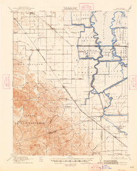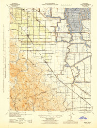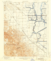
1916 Map of Byron
USGS Topo · Published 1941About this map
The delta wetlands of the San Joaquin River system define this early 20th-century landscape, where a complex network of reclaimed tracts and islands meet the foothills of the Diablo Range. Major landforms like Holland Tract, Bacon Island, and Victoria Island are partitioned by an intricate system of sloughs and man-made canals such as the Grant Line Canal and Victoria Canal. These low-lying agricultural areas rely on numerous pumping plants to manage water levels, reflecting the massive engineering effort required to cultivate the California Delta.
Find a feature on this map
69 named features on this map. Tap any name to fly to it.
Don’t see what you’re looking for? This feature index may not catch every label — zoom into the map to look around manually.
Map Details
Editions of this 1916 Byron Map
3 editions found