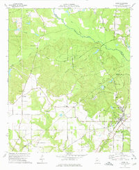
1974 Map of Byron
USGS Topo · Published 1976About this map
Byron serves as the focal point of this mid-1970s landscape, situated at the junction of the Central of Georgia railroad and significant regional thoroughfares like Macon Road. The area is characterized by numerous country churches that anchor the rural community, including Hardison Ch, Jordan Chapel, and Friendship Ch. To the north and west, the terrain is defined by the convergence of several waterways such as Echeconnee Creek, Gum Branch, and Juniper Creek, which carve through the wooded landscape. The presence of Camp Benjamin Hawkins and the scattered rural cemeteries like Waldron Cem and Society Hill Cem reflect a deeply settled interior where family and social institutions remained closely tied to the land. This survey captures a moment of transition where traditional road networks like Old Macon Road intersect with modern land-use patterns, including a prominent Landing Strip and the growth of local trailer parks near the rail line.
Find a feature on this map
35 named features on this map. Tap any name to fly to it.
Don’t see what you’re looking for? This feature index may not catch every label — zoom into the map to look around manually.
Map Details
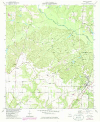
Editions of this 1974 Byron Map
2 editions found
Other maps of this area

1956 · Fort Valley
USGS Topo · 1:62,500

1956 · Bolingbroke
USGS Topo · 1:62,500

1956 · Warner Robins
USGS Topo · 1:62,500

1956 · Macon West
USGS Topo · 1:24,000

1956 · Macon
USGS Topo · 1:62,500

1957 · Macon
USGS Topo · 1:250,000

1958 · Macon
USGS Topo · 1:250,000

1964 · Macon
USGS Topo · 1:250,000
1973 · Fort Valley West
USGS Topo · 1:24,000
1973 · Warner Robins SW
USGS Topo · 1:24,000