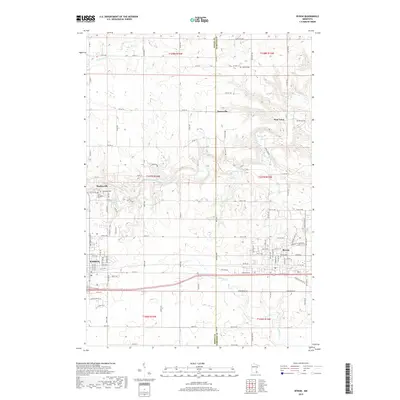
2019 Map of Byron
USGS Topo · Published 2019About this map
Kasson and Byron define the southern corridor of this landscape, situated along a primary transportation route that bridges the border between Dodge and Olmsted counties. The region is characterized by a sophisticated drainage network feeding into the Middle Fork Zumbro River, with several smaller tributaries such as Tompkins Creek and Cascade Creek carving subtle valleys through the surrounding farmland. These watercourses historically influenced the placement of early settlements and rural hubs like Danesville and Post Town, which remain identified as distinct points on this modern survey. Local history is well-preserved through a series of community landmarks, including the Byron Cemetery and Saint Margaret Cemetery near Mantorville. The map illustrates the contemporary layout of these growing southeastern Minnesota towns while maintaining the spatial context of the original township and range system.
Find a feature on this map
108 named features on this map. Tap any name to fly to it.
Don’t see what you’re looking for? This feature index may not catch every label — zoom into the map to look around manually.
Map Details
Editions of this 2019 Byron Map
This is the sole edition of this map. No revisions or reprints were ever made.
Other maps of this area

1953 · Saint Paul
USGS Topo · 1:250,000

1954 · Mason City
USGS Topo · 1:250,000

1955 · High Forest
USGS Topo · 1:62,500

1957 · Mason City
USGS Topo · 1:250,000

1958 · Mason City
USGS Topo · 1:250,000

1959 · Saint Paul
USGS Topo · 1:250,000

1965 · Dodge Center
USGS Topo · 1:24,000

1965 · Concord
USGS Topo · 1:24,000

1965 · Oronoco
USGS Topo · 1:24,000

1965 · Byron
USGS Topo · 1:24,000