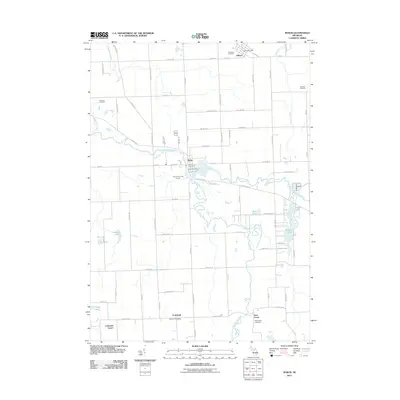
2011 Map of Byron
USGS Topo · Published 2011About this map
The Shiawassee River and its South Branch serve as the central geographic features of this mid-Michigan landscape, anchoring the village of Byron. The river system creates a winding corridor of small lakes and wetlands, including Kanause Lake, Mud Lake, and McKane Lake, which distinguish the area from the surrounding agricultural grid. Settlement patterns are concentrated around historic post office hubs like Gaines, Cohoctah, and Deer Creek. Local genealogy and land use are well-documented through numerous burial grounds such as Oakwood Cemetery, Byron Cemetery, and the Atherton Cemetery. The presence of the Willowbrook Golf Course and several rural post offices indicates a community that maintains its small-town infrastructure and recreational spaces while preserving its traditional township boundaries.
Find a feature on this map
80 named features on this map. Tap any name to fly to it.
Don’t see what you’re looking for? This feature index may not catch every label — zoom into the map to look around manually.
Map Details
Editions of this 2011 Byron Map
This is the sole edition of this map. No revisions or reprints were ever made.
Other maps of this area

1907 · Howell
USGS Topo · 1:62,500

1908 · Fowlerville
USGS Topo · 1:62,500

1909 · Howell
USGS Topo · 1:62,500

1910 · Fowlerville
USGS Topo · 1:62,500

1922 · Durand
USGS Topo · 1:62,500

1926 · Corunna
USGS Topo · 1:62,500

1929 · Corunna
USGS Topo · 1:62,500

1943 · Durand
USGS Topo · 1:62,500

1944 · Corunna
USGS Topo · 1:62,500

1954 · Detroit
USGS Topo · 1:250,000