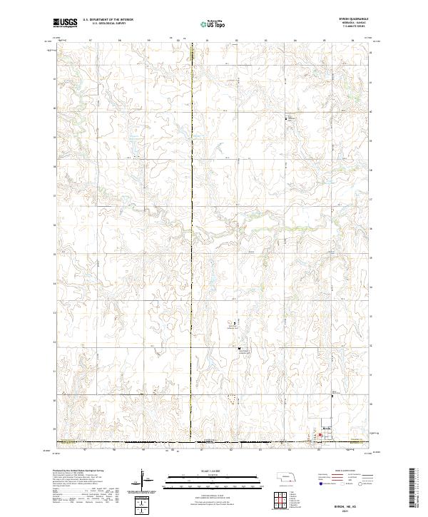
2021 Map of Byron
USGS Topo · Published 2021About this map
Byron serves as the focal point for this rural landscape where the plains of Thayer County meet the Kansas border. This 2021 topography reveals a community deeply rooted in its Lutheran heritage, evidenced by a series of significant burial grounds including Saint Paul Lutheran Cem, Saint Peters Lutheran Cem, and Zion Lutheran Cem. The terrain is defined by the headwaters of Spring Cr and Otter Cr, which carve subtle drainage patterns across the agricultural grid. Local water management is represented by several private impoundments such as Eggers Reservoir and Hofts Reservoir, reflecting the necessity of irrigation and livestock water in this border region. The map also identifies the village Po, marking the local center of mail and community life at the intersection of Co Rd A.
Find a feature on this map
33 named features on this map. Tap any name to fly to it.
Don’t see what you’re looking for? This feature index may not catch every label — zoom into the map to look around manually.
Map Details
Editions of this 2021 Byron Map
This is the sole edition of this map. No revisions or reprints were ever made.
Other maps of this area

1892 · Concordia
USGS Topo · 1:125,000

1898 · Hebron
USGS Topo · 1:125,000

1955 · Manhattan
USGS Topo · 1:250,000

1955 · Lincoln
USGS Topo · 1:250,000

1956 · Manhattan
USGS Topo · 1:250,000

1957 · Manhattan
USGS Topo · 1:250,000

1957 · Lincoln
USGS Topo · 1:250,000

1958 · Lincoln
USGS Topo · 1:250,000

1960 · Byron
USGS Topo · 1:24,000
1960 · Oak
USGS Topo · 1:24,000