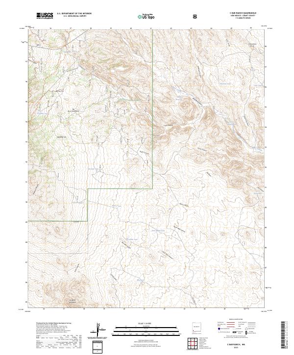
2023 Map of C Bar Ranch
USGS Topo · Published 2023About this map
The Big Burro Mountains and the Langford Mountains anchor this high-elevation landscape within the Gila National Forest. This modern 2023 survey provides a detailed view of the water-management infrastructure essential for ranching in this arid environment, evidenced by dozens of strategically placed water features such as Mine Tank, Big Laddie Tank, and Glaze Reservoir. The Continental Divide winds through the eastern portion of the quadrangle, crossed by the Continental Divide National Scenic Trl. Movement through the undulating terrain is defined by historic corridors like the Walking X Ranch Rd and C Bar Ranch Rd, which follow natural breaks like Walking X Canyon. The presence of Werney Flat and Whitetop Hill highlights the varied topography, while the Burro Cienaga drainage indicates a crucial riparian zone amidst the surrounding canyons and draws.
Find a feature on this map
49 named features on this map. Tap any name to fly to it.
Don’t see what you’re looking for? This feature index may not catch every label — zoom into the map to look around manually.
Map Details
Editions of this 2023 C Bar Ranch Map
This is the sole edition of this map. No revisions or reprints were ever made.
Other maps of this area

1909 · Silver City
USGS Topo · 1:125,000

1950 · White Signal
USGS Topo · 1:24,000

1950 · Burro Peak
USGS Topo · 1:24,000

1951 · White Signal
USGS Topo · 1:24,000

1951 · Big Burro Mountains
USGS Topo · 1:24,000

1954 · Silver City
USGS Topo · 1:250,000

1958 · Silver City
USGS Topo · 1:250,000

1959 · Redrock
USGS Topo · 1:62,500

1962 · Silver City
USGS Topo · 1:250,000

1962 · Ninetysix Ranch
USGS Topo · 1:24,000