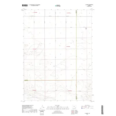
2017 Map of C S Ranch
USGS Topo · Published 2017About this map
Iowa Center Flats dominates the northeastern terrain of this high plains region, where the borders of Platte, Goshen, and Laramie counties converge. The landscape is primarily defined by large-scale agricultural and ranching operations, centered around the C S Ranch. This 2017 survey illustrates a modern grid of rural access roads, including Lone Tree Rd and Lancer Rd, which navigate the subtle elevation changes of the Platte River valley watershed.
Find a feature on this map
25 named features on this map. Tap any name to fly to it.
Don’t see what you’re looking for? This feature index may not catch every label — zoom into the map to look around manually.
Map Details
Editions of this 2017 C S Ranch Map
This is the sole edition of this map. No revisions or reprints were ever made.
Other maps of this area

1953 · Chugwater
USGS Topo · 1:24,000

1954 · Cheyenne
USGS Topo · 1:250,000

1958 · Cheyenne
USGS Topo · 1:250,000

1962 · Moffett Ranch
USGS Topo · 1:24,000

1962 · Bristol Ridge NE
USGS Topo · 1:24,000

1963 · C S Ranch
USGS Topo · 1:24,000

1963 · Y B O Canyon
USGS Topo · 1:24,000
1963 · Cattail Ranch
USGS Topo · 1:24,000

1963 · Klutz Canyon
USGS Topo · 1:24,000
1963 · Cattail Ranch NE
USGS Topo · 1:24,000