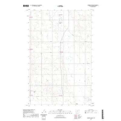
2020 Map of Cabarett Coulee
USGS Topo · Published 2020About this map
The Poplar River winds through the heart of this Montana landscape, cutting a path through the high plains of Daniels County. The terrain is defined by a network of drainage channels, including Manternach Coulee, Negro Coulee, and Cabarett Coulee, which create a complex topography typical of the Wolf Point District. For those researching family history in the region, the Fairview Cem stands as a significant landmark along Old Scobey Rd in the southwestern portion of the map. A grid of rural roads, such as Bekker Rd, Silver Star Rd, and Wolfard Rd, provides access to the isolated ranching and farming tracts that characterize this section of the northern plains. The map illustrates the persistent intersection of natural watercourses and the human infrastructure required to navigate this expansive territory.
Find a feature on this map
20 named features on this map. Tap any name to fly to it.
Don’t see what you’re looking for? This feature index may not catch every label — zoom into the map to look around manually.
Map Details
Editions of this 2020 Cabarett Coulee Map
This is the sole edition of this map. No revisions or reprints were ever made.
Other maps of this area

1954 · Wolf Point
USGS Topo · 1:250,000

1958 · Wolf Point
USGS Topo · 1:250,000

1973 · Madoc
USGS Topo · 1:24,000

1973 · Peerless 4 NE
USGS Topo · 1:24,000

1973 · Bredette
USGS Topo · 1:24,000

1973 · Line Coulee
USGS Topo · 1:24,000

1973 · Scobey
USGS Topo · 1:24,000

1973 · Nielsen Coulee
USGS Topo · 1:24,000

1973 · Cabarett Coulee
USGS Topo · 1:24,000

1973 · Peerless 4 SE
USGS Topo · 1:24,000