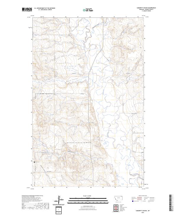
2024 Map of Cabarett Coulee
USGS Topo · Published 2024About this map
The Poplar River winds through this section of Daniels County, Montana, cutting a distinct valley through the northern plains. This landscape is defined by its drainage network, where numerous coulees like Cabarett Coulee and Negro Coulee feed toward the river basin. The map reveals a remote ranching and farming environment structured by the Public Land Survey System, with roads often following section lines or natural terrain features. Local history is anchored at Fairview Cem near the southern boundary, while family-named routes such as Bekker Rd, Fugere Rd, and Lekvold Rd hint at the area's homesteading heritage. This recent data shows the persistence of rural life in the high plains, where water sources like the 33N48E06ABBB01 Spring and seasonal coulees dictate the movement across the terrain.
Find a feature on this map
21 named features on this map. Tap any name to fly to it.
Don’t see what you’re looking for? This feature index may not catch every label — zoom into the map to look around manually.
Map Details
Editions of this 2024 Cabarett Coulee Map
This is the sole edition of this map. No revisions or reprints were ever made.
Other maps of this area

1954 · Wolf Point
USGS Topo · 1:250,000

1958 · Wolf Point
USGS Topo · 1:250,000

1973 · Madoc
USGS Topo · 1:24,000

1973 · Peerless 4 NE
USGS Topo · 1:24,000

1973 · Bredette
USGS Topo · 1:24,000

1973 · Line Coulee
USGS Topo · 1:24,000

1973 · Scobey
USGS Topo · 1:24,000

1973 · Nielsen Coulee
USGS Topo · 1:24,000

1973 · Cabarett Coulee
USGS Topo · 1:24,000

1973 · Peerless 4 SE
USGS Topo · 1:24,000