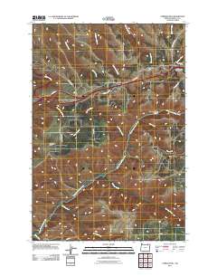
2011 Map of Cabbage Hill
USGS Topo · Published 2011About this map
Cabbage Hill and Emigrant Hill dominate this portion of Umatilla County, marking the steep ascent into the Blue Mountains east of Pendleton. The map detail highlights the complex transport engineering required to traverse Deadman Pass, where Interstate 84 winds through high-elevation terrain. This corridor has long served as a vital passage for travelers, evidenced by the presence of the Deadman Pass Safety Rest Area and several historical thoroughfares like Emigrant Rd and Poverty Flat Rd.
Find a feature on this map
26 named features on this map. Tap any name to fly to it.
Don’t see what you’re looking for? This feature index may not catch every label — zoom into the map to look around manually.
Map Details
Editions of this 2011 Cabbage Hill Map
This is the sole edition of this map. No revisions or reprints were ever made.
Other maps of this area

1935 · Pendleton
USGS Topo · 1:125,000

1953 · Pendleton
USGS Topo · 1:250,000

1956 · Pendleton
USGS Topo · 1:250,000

1963 · Meacham Lake
USGS Topo · 1:24,000

1964 · Thorn Hollow
USGS Topo · 1:24,000

1964 · Meacham
USGS Topo · 1:24,000

1966 · Cabbage Hill
USGS Topo · 1:24,000
1966 · Cayuse
USGS Topo · 1:24,000

1966 · Table Rock
USGS Topo · 1:24,000

1966 · Mission
USGS Topo · 1:24,000