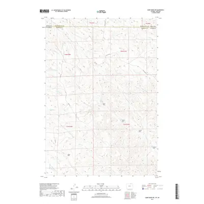
2017 Map of Cabin Creek NW
USGS Topo · Published 2017About this map
Squaw Butte dominates the southern landscape of this Sheridan County quadrangle, situated along the Montana and Wyoming border. This high-plains terrain is defined by an intricate network of drainages and seasonal watercourses that have carved the land into a series of draws and prongs. The hydrology of the region is centered on systems like Trail Cr, Fence Cr, and Seventysix Cr, which weave through the townships. The naming conventions of the landscape, such as Sawmill Draw and Schoolhouse Prong, hint at the historic ranching and early settlement activities that once utilized these specific topographical features for shelter or resources. Transportation across this remote borderland is limited to primary corridors like Passaic Rd and Fence Creek Rd, which follow the natural contours of the land to connect disparate cattle ranges and homesteads.
Find a feature on this map
29 named features on this map. Tap any name to fly to it.
Don’t see what you’re looking for? This feature index may not catch every label — zoom into the map to look around manually.
Map Details
Editions of this 2017 Cabin Creek NW Map
This is the sole edition of this map. No revisions or reprints were ever made.
Other maps of this area

1954 · Hardin
USGS Topo · 1:250,000

1955 · Sheridan
USGS Topo · 1:250,000

1957 · Hardin
USGS Topo · 1:250,000

1958 · Hardin
USGS Topo · 1:250,000

1958 · Sheridan
USGS Topo · 1:250,000

1962 · Sheridan
USGS Topo · 1:250,000

1971 · Cabin Creek NW
USGS Topo · 1:24,000

1971 · Cabin Creek SE
USGS Topo · 1:24,000
1971 · Cabin Creek NE
USGS Topo · 1:24,000

1971 · Gardner Gulch
USGS Topo · 1:24,000