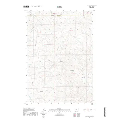
2021 Map of Cabin Creek NW
USGS Topo · Published 2021About this map
State Line Rd traces the remote border between Montana and Wyoming, dividing the high plains of Powder River County from Sheridan County. This interior landscape is defined by a dense network of seasonal drainages and named topographic landmarks that suggest early grazing and timber activity. Distinctive family or descriptive names like Tanney Draw, Robling Draw, and Sawmill Draw mark the erosional features carving into the plateau.
Find a feature on this map
21 named features on this map. Tap any name to fly to it.
Don’t see what you’re looking for? This feature index may not catch every label — zoom into the map to look around manually.
Map Details
Editions of this 2021 Cabin Creek NW Map
This is the sole edition of this map. No revisions or reprints were ever made.
Other maps of this area

1954 · Hardin
USGS Topo · 1:250,000

1955 · Sheridan
USGS Topo · 1:250,000

1957 · Hardin
USGS Topo · 1:250,000

1958 · Hardin
USGS Topo · 1:250,000

1958 · Sheridan
USGS Topo · 1:250,000

1962 · Sheridan
USGS Topo · 1:250,000

1971 · Cabin Creek NW
USGS Topo · 1:24,000

1971 · Cabin Creek SE
USGS Topo · 1:24,000
1971 · Cabin Creek NE
USGS Topo · 1:24,000

1971 · Gardner Gulch
USGS Topo · 1:24,000