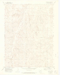
1970 Map of Cabin Gulch
USGS Topo · Published 1973About this map
Running Creek and its many tributaries, including Whiskey Gulch and Henderson Gulch, define the drainage patterns of this corner of Elbert County during the late 1960s. The landscape is marked by a mix of agricultural infrastructure and early modernization, featuring a Landing Strip, a Radio Tower, and a Pipeline cutting across the terrain. For those tracing local family history, the Miller Cem is a significant genealogical landmark. Evidence of older transportation and social gathering is found in the Old Railroad Grade in the southwest and the Church Camp near the center of the sheet. The survey also captures numerous small livestock or agricultural features like a Spring and multiple Gravel Pits, while Timber Claim Gulch points toward the area's early land use history.
Find a feature on this map
18 named features on this map. Tap any name to fly to it.
Don’t see what you’re looking for? This feature index may not catch every label — zoom into the map to look around manually.
Map Details
Editions of this 1970 Cabin Gulch Map
4 editions found
Other maps of this area

1890 · East Denver
USGS Topo · 1:125,000

1894 · Castle Rock
USGS Topo · 1:125,000

1913 · Castle Rock
USGS Topo · 1:125,000

1939 · Elizabeth
USGS Topo · 1:62,500

1940 · Piney Creek
USGS Topo · 1:24,000

1942 · Piney Creek
USGS Topo · 1:31,680

1945 · Elizabeth
USGS Topo · 1:62,500

1953 · Denver
USGS Topo · 1:250,000

1955 · Watkins SE
USGS Topo · 1:24,000

1957 · Denver
USGS Topo · 1:250,000