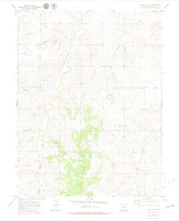
1970 Map of Cabin Gulch
USGS Topo · Published 1980About this map
Running Creek and its associated bottomlands form the central axis of this Elbert County landscape, where the topography transitions from high, open plateaus into a series of deeply carved drainage systems. The presence of the Miller Cem and a Church Camp suggests established rural social hubs that persisted into the late 20th century. This 1970s era documentation, with photogrammetric revisions, reveals a shift toward modern utility and recreation, noted by the inclusion of a Landing Strip, a Radio Tower, and an extensive Pipeline cutting across the eastern sections. Water management and drainage are critical themes here, illustrated by the naming of various localized features such as Whiskey Gulch, Gold Creek, and Hay Gulch, which define the rugged character of the ranching and agricultural country south of Watkins and Parker.
Find a feature on this map
18 named features on this map. Tap any name to fly to it.
Don’t see what you’re looking for? This feature index may not catch every label — zoom into the map to look around manually.
Map Details
Editions of this 1970 Cabin Gulch Map
4 editions found
Other maps of this area

1890 · East Denver
USGS Topo · 1:125,000

1894 · Castle Rock
USGS Topo · 1:125,000

1913 · Castle Rock
USGS Topo · 1:125,000

1939 · Elizabeth
USGS Topo · 1:62,500

1940 · Piney Creek
USGS Topo · 1:24,000

1942 · Piney Creek
USGS Topo · 1:31,680

1945 · Elizabeth
USGS Topo · 1:62,500

1953 · Denver
USGS Topo · 1:250,000

1955 · Watkins SE
USGS Topo · 1:24,000

1957 · Denver
USGS Topo · 1:250,000