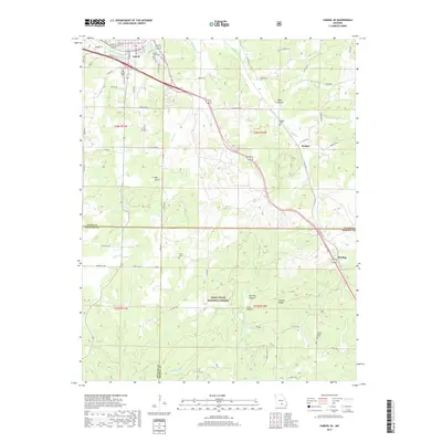
2017 Map of Cabool SE
USGS Topo · Published 2017About this map
The Big Piney River cuts through the northern reach of this landscape, where the town of Cabool serves as a regional hub at the convergence of local routes. The terrain transitions from the developed grid of the town center to the dense timber of the Mark Twain National Forest further south. Genealogists and local historians can locate several rural burying grounds, including Cabool Cem, Cedar Bluff Cem, and Jones Cem, which anchor the surrounding homesteads and small communities like Sargent and Sterling.
Find a feature on this map
59 named features on this map. Tap any name to fly to it.
Don’t see what you’re looking for? This feature index may not catch every label — zoom into the map to look around manually.
Map Details
Editions of this 2017 Cabool SE Map
This is the sole edition of this map. No revisions or reprints were ever made.
Other maps of this area

1939 · Topaz
USGS Topo · 1:62,500

1941 · Topaz
USGS Topo · 1:62,500

1945 · Harrison
USGS Topo · 1:250,000

1945 · Willow Springs
USGS Topo · 1:62,500

1945 · Clear Springs
USGS Topo · 1:62,500

1948 · Clear Springs
USGS Topo · 1:62,500

1948 · Willow Springs
USGS Topo · 1:62,500

1949 · Harrison
USGS Topo · 1:250,000

1949 · Rolla
USGS Topo · 1:250,000

1950 · Cabool SW
USGS Topo · 1:24,000