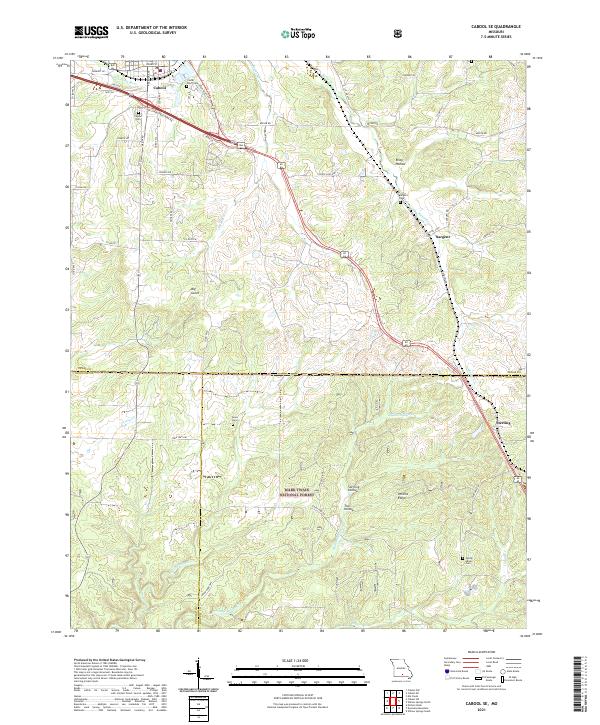
2021 Map of Cabool SE
USGS Topo · Published 2021About this map
Cabool marks the northwestern corner of this map, situated where the Big Piney River flows north past the Cedar Bluff Cem and Cabool Cem. The landscape transitions south and east into the rugged Ozark terrain of the Mark Twain National Forest, characterized by deep valleys like Sterling Hollow and prominent elevations such as Perkins Ridge. The small settlements of Sargent and Sterling anchor the eastern side of the survey area, connected by a network of rural roads that follow the winding drainages of Potter Cr and Middle Indian Cr.
Find a feature on this map
60 named features on this map. Tap any name to fly to it.
Don’t see what you’re looking for? This feature index may not catch every label — zoom into the map to look around manually.
Map Details
Editions of this 2021 Cabool SE Map
This is the sole edition of this map. No revisions or reprints were ever made.
Other maps of this area

1939 · Topaz
USGS Topo · 1:62,500

1941 · Topaz
USGS Topo · 1:62,500

1945 · Harrison
USGS Topo · 1:250,000

1945 · Willow Springs
USGS Topo · 1:62,500

1945 · Clear Springs
USGS Topo · 1:62,500

1948 · Clear Springs
USGS Topo · 1:62,500

1948 · Willow Springs
USGS Topo · 1:62,500

1949 · Harrison
USGS Topo · 1:250,000

1949 · Rolla
USGS Topo · 1:250,000

1950 · Cabool SW
USGS Topo · 1:24,000