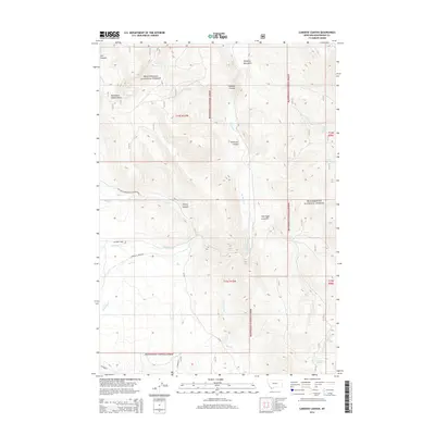
2014 Map of Caboose Canyon
USGS Topo · Published 2014About this map
Beaverhead National Forest dominates this high-elevation landscape in Beaverhead County, Montana, where the terrain is deeply carved by numerous canyons and seasonal drainages. The map reveals a complex network of water sources essential for this environment, ranging from Wood Spring in the northwest to the Continental Spring in the southeast. Named features like Caboose Canyon and Shearing Pen Gulch suggest a history of localized naming by early surveyors or ranching interests. Transportation is limited to a few established routes such as the Big Sheep Creek Back Country Bywy, which follows the course of Big Sheep Cr through the heart of the territory. This map records the drainage patterns and topographical landmarks of a region defined by its isolation and its role as a watershed for the Nicholia Cr and Rock Cr valleys.
Find a feature on this map
29 named features on this map. Tap any name to fly to it.
Don’t see what you’re looking for? This feature index may not catch every label — zoom into the map to look around manually.
Map Details
Editions of this 2014 Caboose Canyon Map
This is the sole edition of this map. No revisions or reprints were ever made.
Other maps of this area

1955 · Dubois
USGS Topo · 1:250,000

1957 · Scott Peak
USGS Topo · 1:62,500

1957 · Edie Ranch
USGS Topo · 1:62,500

1958 · Dubois
USGS Topo · 1:250,000

1965 · Caboose Canyon
USGS Topo · 1:24,000

1965 · Gallagher Gulch
USGS Topo · 1:24,000

1965 · Graphite Mountain
USGS Topo · 1:24,000

1965 · Dixon Mountain
USGS Topo · 1:24,000

1965 · Dell
USGS Topo · 1:24,000

1965 · Island Butte
USGS Topo · 1:24,000