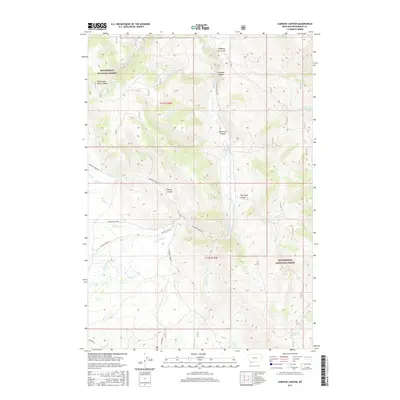
2017 Map of Caboose Canyon
USGS Topo · Published 2017About this map
Beaverhead National Forest land defines the high-altitude topography of this corner of Beaverhead County, where deep drainages like Caboose Canyon and Patterson Canyon cut through the landscape. This area is characterized by an intricate network of seasonal and perennial water sources, including the headwaters of Nicholia Creek and the meandering Big Sheep Creek. Cattle and sheep ranching history is evidenced by features such as Shearing Pen Gulch, while the naming of Four Eyes Canyon and Pileup Canyon reflects the local vernacular of the region. Transportation follows the natural contours of the valley floors, with Medicine Lodge Rd and Big Sheep Creek Rd serving as the primary arteries through the mountainous terrain.
Find a feature on this map
32 named features on this map. Tap any name to fly to it.
Don’t see what you’re looking for? This feature index may not catch every label — zoom into the map to look around manually.
Map Details
Editions of this 2017 Caboose Canyon Map
This is the sole edition of this map. No revisions or reprints were ever made.
Other maps of this area

1955 · Dubois
USGS Topo · 1:250,000

1957 · Scott Peak
USGS Topo · 1:62,500

1957 · Edie Ranch
USGS Topo · 1:62,500

1958 · Dubois
USGS Topo · 1:250,000

1965 · Caboose Canyon
USGS Topo · 1:24,000

1965 · Gallagher Gulch
USGS Topo · 1:24,000

1965 · Graphite Mountain
USGS Topo · 1:24,000

1965 · Dixon Mountain
USGS Topo · 1:24,000

1965 · Dell
USGS Topo · 1:24,000

1965 · Island Butte
USGS Topo · 1:24,000