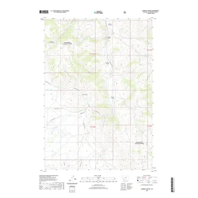
2020 Map of Caboose Canyon
USGS Topo · Published 2020About this map
Beaverhead National Forest defines the high-country character of this 2020 landscape in Beaverhead County. The terrain is marked by a series of significant drainage systems and canyons, including Caboose Canyon, Patterson Canyon, and Four Eyes Canyon, which run toward the primary waterway of Big Sheep Creek. This modern survey illustrates the persistent importance of established mountain corridors like Medicine Lodge Rd and Big Sheep Creek Rd, routes that follow the natural contours of the land much as they have for generations. Water remains a critical resource in this arid environment, noted by numerous scattered sources such as Continental Spring, Caboose Spring, and Wood Spring. The map provides a precise look at the drainage network where Nicholia Creek and Rock Creek intersect the lower elevations, framed by the rigid administrative boundaries of the Public Land Survey System.
Find a feature on this map
32 named features on this map. Tap any name to fly to it.
Don’t see what you’re looking for? This feature index may not catch every label — zoom into the map to look around manually.
Map Details
Editions of this 2020 Caboose Canyon Map
This is the sole edition of this map. No revisions or reprints were ever made.
Other maps of this area

1955 · Dubois
USGS Topo · 1:250,000

1957 · Scott Peak
USGS Topo · 1:62,500

1957 · Edie Ranch
USGS Topo · 1:62,500

1958 · Dubois
USGS Topo · 1:250,000

1965 · Caboose Canyon
USGS Topo · 1:24,000

1965 · Gallagher Gulch
USGS Topo · 1:24,000

1965 · Graphite Mountain
USGS Topo · 1:24,000

1965 · Dixon Mountain
USGS Topo · 1:24,000

1965 · Dell
USGS Topo · 1:24,000

1965 · Island Butte
USGS Topo · 1:24,000