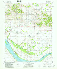
1978 Map of Caborn
USGS Topo · Published 1979About this map
The Ohio River shoreline in Posey County serves as the focal point of this late 1970s landscape, where industrial developments like the Southwind Maritime Centre meet the agricultural traditions of southwestern Indiana. This survey captures a rural network of small communities including Bufkin, Caborn, and Marrs Center, interconnected by the Louisville and Nashville Railroad. The map reveals a land heavily shaped by drainage engineering and resource extraction, evidenced by the numerous Oil Wells peppered across the northern uplands and the complex irrigation of Dixon Ditch and Cypress Slough.
Find a feature on this map
30 named features on this map. Tap any name to fly to it.
Don’t see what you’re looking for? This feature index may not catch every label — zoom into the map to look around manually.
Map Details
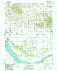
Editions of this 1978 Caborn Map
2 editions found
Other maps of this area

1901 · Haubstadt
USGS Topo · 1:62,500

1903 · Haubstadt
USGS Topo · 1:62,500

1903 · New Harmony
USGS Topo · 1:62,500

1903 · Patoka
USGS Topo · 1:125,000

1914 · Henderson
USGS Topo · 1:48,000

1916 · Henderson
USGS Topo · 1:62,500

1917 · Uniontown
USGS Topo · 1:62,500

1938 · New Harmony
USGS Topo · 1:62,500
1952 · Mount Vernon
USGS Topo · 1:24,000
1952 · Wilson
USGS Topo · 1:24,000