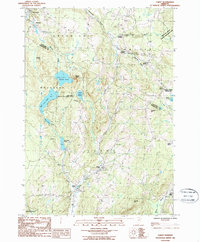
1986 Map of Cabot
USGS Topo · Published 1987About this map
The upper reaches of the Winooski River and Mollys Brook define this 1980s landscape at the border of Washington and Caledonia Counties. The map documents the village of Cabot and its surrounding hamlets, including Lower Cabot and Cabot Plains, before significant modern development altered these rural corridors. To the north, the terrain transitions into the town of Hardwick and the smaller settlement of Mackville, with Haynesville Brook draining the northern slopes.
Find a feature on this map
38 named features on this map. Tap any name to fly to it.
Don’t see what you’re looking for? This feature index may not catch every label — zoom into the map to look around manually.
Map Details
Editions of this 1986 Cabot Map
2 editions found
Other maps of this area

1928 · Hardwick
USGS Topo · 1:62,500

1934 · Hardwick
USGS Topo · 1:48,000

1935 · Lyndonville
USGS Topo · 1:48,000

1938 · Hardwick
USGS Topo · 1:62,500

1938 · St. Johnsbury
USGS Topo · 1:48,000

1939 · Lyndonville
USGS Topo · 1:62,500

1939 · Plainfield
USGS Topo · 1:48,000

1940 · Plainfield
USGS Topo · 1:62,500

1943 · Plainfield
USGS Topo · 1:62,500

1943 · St. Johnsbury
USGS Topo · 1:62,500