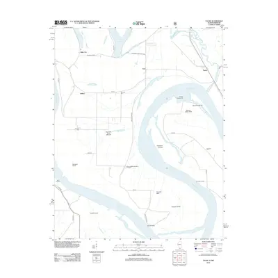
2012 Map of Cache
USGS Topo · Published 2012About this map
Dogtooth Bend defines the dramatic southern sweep of the Mississippi River in this 2012 survey of Alexander County, where the river's shifting path has created a complex landscape of chutes and islands. The settlement of Miller City sits at the edge of the Horseshoe Lake drainage, while smaller hamlets like Roth and Willard anchor the interior bottomlands. This area is a patchwork of agricultural fields and conservation lands, including the Horseshoe Lake Consrv Area.
Find a feature on this map
41 named features on this map. Tap any name to fly to it.
Don’t see what you’re looking for? This feature index may not catch every label — zoom into the map to look around manually.
Map Details
Editions of this 2012 Cache Map
This is the sole edition of this map. No revisions or reprints were ever made.
Other maps of this area

1931 · Cairo
USGS Topo · 1:62,500

1933 · Cairo
USGS Topo · 1:62,500

1934 · Thebes
USGS Topo · 1:62,500

1939 · Wickliffe
USGS Topo · 1:62,500

1939 · Charleston
USGS Topo · 1:62,500

1939 · Cairo
USGS Topo · 1:62,500

1939 · Thebes
USGS Topo · 1:62,500

1949 · Paducah
USGS Topo · 1:250,000

1950 · Paducah
USGS Topo · 1:250,000

1952 · Wickliffe
USGS Topo · 1:62,500