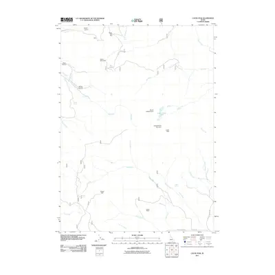
2011 Map of Cache Peak
USGS Topo · Published 2011About this map
Cache Peak and the surrounding Albion Mountains define this high-altitude landscape in Cassia County. The terrain is characterized by complex drainage patterns where numerous springs, including Salt Lick Spring, Logger Spring, and Sanford Spring, feed into a network of creeks such as Mill Creek, Almo Creek, and Cassia Creek. High-elevation landmarks like Mount Independence and the Independence Lakes offer a detailed view of the regional topography, while Castle Rocks stands out as a significant geological feature near the southern boundary.
Find a feature on this map
42 named features on this map. Tap any name to fly to it.
Don’t see what you’re looking for? This feature index may not catch every label — zoom into the map to look around manually.
Map Details
Editions of this 2011 Cache Peak Map
This is the sole edition of this map. No revisions or reprints were ever made.
Other maps of this area

1954 · Pocatello
USGS Topo · 1:250,000

1958 · Pocatello
USGS Topo · 1:250,000

1968 · Almo
USGS Topo · 1:24,000

1968 · Cache Peak
USGS Topo · 1:24,000

1968 · Basin
USGS Topo · 1:24,000

1968 · Jim Sage Canyon
USGS Topo · 1:24,000

1968 · Marion SE
USGS Topo · 1:24,000

1968 · Elba
USGS Topo · 1:24,000

1968 · Mount Harrison
USGS Topo · 1:24,000

1968 · Lyman Pass
USGS Topo · 1:24,000