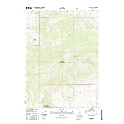
2017 Map of Cache Peak
USGS Topo · Published 2017About this map
The high summits of the Albion Mountains dominate this 2017 survey, where granite formations and alpine waters define the southern Idaho landscape. High elevation landmarks including Cache Peak and Mount Independence rise above the Sawtooth National Forest, providing a backdrop for the dramatic geological features of the City of Rocks National Reserve. The map details the transition from high mountain peaks to the broad basins of Big Cove and Little Cove, which are accessed by local cattle and ranching routes like Big Cove Ranch Rd. Numerous water sources, including the high-altitude Independence Lakes and lower springs such as Logger Spring and Heath Spring, indicate the vital role of water management for the region's ranching interests. At the northern edge, the Basin-Elba Pass serves as a critical connection through the mountains, following the path of the Oakley-Elba Rd.
Find a feature on this map
56 named features on this map. Tap any name to fly to it.
Don’t see what you’re looking for? This feature index may not catch every label — zoom into the map to look around manually.
Map Details
Editions of this 2017 Cache Peak Map
This is the sole edition of this map. No revisions or reprints were ever made.
Other maps of this area

1954 · Pocatello
USGS Topo · 1:250,000

1958 · Pocatello
USGS Topo · 1:250,000

1968 · Almo
USGS Topo · 1:24,000

1968 · Cache Peak
USGS Topo · 1:24,000

1968 · Basin
USGS Topo · 1:24,000

1968 · Jim Sage Canyon
USGS Topo · 1:24,000

1968 · Marion SE
USGS Topo · 1:24,000

1968 · Elba
USGS Topo · 1:24,000

1968 · Mount Harrison
USGS Topo · 1:24,000

1968 · Lyman Pass
USGS Topo · 1:24,000