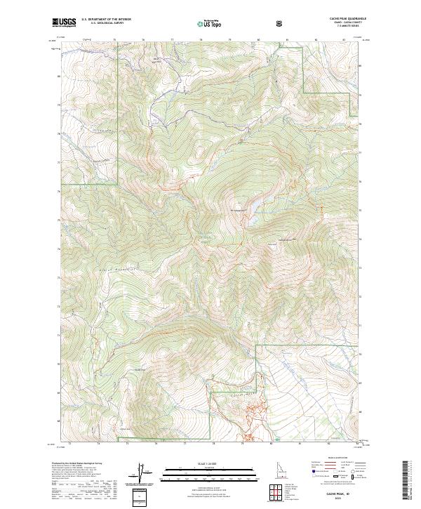
2023 Map of Cache Peak
USGS Topo · Published 2023About this map
The Albion Mountains dominate this high-altitude survey, anchored by the towering heights of Mt Independence and the namesake Cache Peak. Much of the terrain is managed as part of the Sawtooth National Forest, where a network of primitive trails like the Skyline Trl and Ranger Trl navigate complex ridges and passes. Notable geologic and hydrological features including the Pot Holes and the alpine Independence Lakes mark the landscape, while the distinctive formations of Castle Rocks rise in the southern reaches.
Find a feature on this map
56 named features on this map. Tap any name to fly to it.
Don’t see what you’re looking for? This feature index may not catch every label — zoom into the map to look around manually.
Map Details
Editions of this 2023 Cache Peak Map
This is the sole edition of this map. No revisions or reprints were ever made.
Other maps of this area

1954 · Pocatello
USGS Topo · 1:250,000

1958 · Pocatello
USGS Topo · 1:250,000

1968 · Almo
USGS Topo · 1:24,000

1968 · Cache Peak
USGS Topo · 1:24,000

1968 · Basin
USGS Topo · 1:24,000

1968 · Jim Sage Canyon
USGS Topo · 1:24,000

1968 · Marion SE
USGS Topo · 1:24,000

1968 · Elba
USGS Topo · 1:24,000

1968 · Mount Harrison
USGS Topo · 1:24,000

1968 · Lyman Pass
USGS Topo · 1:24,000