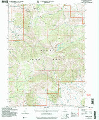
2001 Map of Cache Peak
USGS Topo · Published 2006About this map
Cache Peak and Mount Independence dominate this landscape within the Sawtooth National Forest, marking the dramatic heights of the Albion Mountains at the turn of the 21st century. The map highlights a complex high-altitude environment where the Independence Lakes sit cradled below the peaks, and numerous springs such as Logger Spring and Salt Lick Spring feed the headwaters of Almo Creek and Cassia Creek.
Find a feature on this map
44 named features on this map. Tap any name to fly to it.
Don’t see what you’re looking for? This feature index may not catch every label — zoom into the map to look around manually.
Map Details
Editions of this 2001 Cache Peak Map
This is the sole edition of this map. No revisions or reprints were ever made.
Other maps of this area

1954 · Pocatello
USGS Topo · 1:250,000

1958 · Pocatello
USGS Topo · 1:250,000

1968 · Almo
USGS Topo · 1:24,000

1968 · Cache Peak
USGS Topo · 1:24,000

1968 · Basin
USGS Topo · 1:24,000

1968 · Jim Sage Canyon
USGS Topo · 1:24,000

1968 · Marion SE
USGS Topo · 1:24,000

1968 · Elba
USGS Topo · 1:24,000

1968 · Mount Harrison
USGS Topo · 1:24,000

1968 · Lyman Pass
USGS Topo · 1:24,000