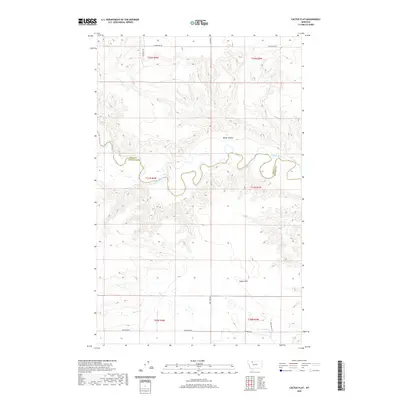
2020 Map of Cactus Flat
USGS Topo · Published 2020About this map
The Marias River carves a winding course through this section of the northern plains, marking the boundary between Toole Co and Pondera Co. The landscape is defined by the broad plateau of Cactus Flat and the deep drainage of Millar Coulee, illustrating the erosional patterns of the High Plains. Evidence of local land management and water infrastructure is visible through features like the An Canal and Heron Lake in the southern portion of the quadrangle. The road network, including Bullhead Rd and Hjartarson Rd, follows the rectangular section lines of the Public Land Survey System, a testament to the systematic agricultural development of Montana's rural interior.
Find a feature on this map
18 named features on this map. Tap any name to fly to it.
Don’t see what you’re looking for? This feature index may not catch every label — zoom into the map to look around manually.
Map Details
Editions of this 2020 Cactus Flat Map
This is the sole edition of this map. No revisions or reprints were ever made.
Other maps of this area

1909 · Cut Bank
USGS Topo · 1:125,000

1912 · Cut Bank
USGS Topo · 1:125,000

1920 · Dupuyer
USGS Topo · 1:125,000

1920 · Conrad
USGS Topo · 1:125,000

1934 · Valier
USGS Topo · 1:62,500

1937 · Valier
USGS Topo · 1:62,500

1943 · Shelby
USGS Topo · 1:62,500

1954 · Shelby
USGS Topo · 1:250,000

1958 · Shelby
USGS Topo · 1:250,000

1960 · Cut Bank
USGS Topo · 1:250,000