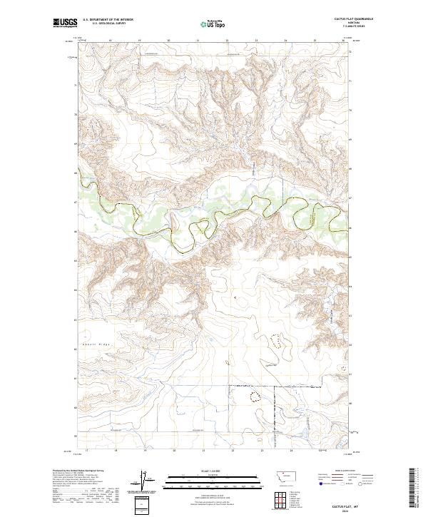
2024 Map of Cactus Flat
USGS Topo · Published 2024About this map
The Marias River carves a deep, winding path through the high plains along the boundary of Toole and Pondera Counties. This northern Montana landscape is defined by the sharp contrast between the flat upland benches and the intricate drainage networks of Millar Coulee and Schultz Coulee. The presence of the AN Canal and Heron Lake in the southern portion of the quadrangle speaks to the vital role of water management in the region's agricultural life, providing irrigation to the expansive plateau around Cactus Flat. A grid of rural routes, including Hjartarson Rd and McCormic Rd, provides access to ranching and farming operations that occupy the sections between Abbott Ridge and the river breaks, illustrating the persistent settlement patterns of this frontier prairie.
Find a feature on this map
20 named features on this map. Tap any name to fly to it.
Don’t see what you’re looking for? This feature index may not catch every label — zoom into the map to look around manually.
Map Details
Editions of this 2024 Cactus Flat Map
This is the sole edition of this map. No revisions or reprints were ever made.
Other maps of this area

1909 · Cut Bank
USGS Topo · 1:125,000

1912 · Cut Bank
USGS Topo · 1:125,000

1920 · Dupuyer
USGS Topo · 1:125,000

1920 · Conrad
USGS Topo · 1:125,000

1934 · Valier
USGS Topo · 1:62,500

1937 · Valier
USGS Topo · 1:62,500

1943 · Shelby
USGS Topo · 1:62,500

1954 · Shelby
USGS Topo · 1:250,000

1958 · Shelby
USGS Topo · 1:250,000

1960 · Cut Bank
USGS Topo · 1:250,000