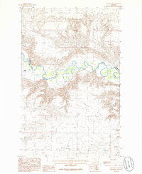
1985 Map of Cactus Flat
USGS Topo · Published 1986About this map
The Marias River carves a winding path through the northern Montana landscape, serving as the border between Pondera Co and Toole Co. This mid-1980s survey illustrates a region defined by its distinct topographical levels, where the high northern benches drop away into the expansive Cactus Flat and the Bullhead Valley to the south. The settlement at Willow Rounds is situated near a sharp bend in the river, highlighting the historic reliance on water sources in this arid environment. Irrigation infrastructure is visible through the presence of a Canal cutting across the southern plains. Natural drainage patterns are further defined by features like Schultz Coulee, which provides insight into the seasonal water flow and erosion that has shaped the local cattle country and farming districts.
Find a feature on this map
7 named features on this map. Tap any name to fly to it.
Don’t see what you’re looking for? This feature index may not catch every label — zoom into the map to look around manually.
Map Details
Editions of this 1985 Cactus Flat Map
This is the sole edition of this map. No revisions or reprints were ever made.
Other maps of this area

1909 · Cut Bank
USGS Topo · 1:125,000

1912 · Cut Bank
USGS Topo · 1:125,000

1920 · Dupuyer
USGS Topo · 1:125,000

1920 · Conrad
USGS Topo · 1:125,000

1934 · Valier
USGS Topo · 1:62,500

1937 · Valier
USGS Topo · 1:62,500

1943 · Shelby
USGS Topo · 1:62,500

1954 · Shelby
USGS Topo · 1:250,000

1958 · Shelby
USGS Topo · 1:250,000

1960 · Cut Bank
USGS Topo · 1:250,000