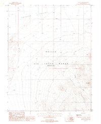
1987 Map of Cactus Peak
USGS Topo · Published 1988About this map
Nellis Air Force Range (Restricted Area) dominates the landscape of Nye County, Nevada, in this late-1980s topographic record. The map reveals the intersection of military activity and high-desert geography, marked by the presence of military Targets situated within the wide expanse of Ralston Valley. The terrain rises sharply toward the southeast, where the Cactus Range takes form, culminating at Cactus Peak. This area's industrial past is visible through a solitary Mine Shaft located near Endless Draw, suggesting early twentieth-century mineral exploration before the land was designated for restricted government use. The map provides a precise look at the drainage patterns and relief of this high-elevation desert environment during a period of ongoing Cold War-era military operations.
Find a feature on this map
10 named features on this map. Tap any name to fly to it.
Don’t see what you’re looking for? This feature index may not catch every label — zoom into the map to look around manually.
Map Details
Editions of this 1987 Cactus Peak Map
This is the sole edition of this map. No revisions or reprints were ever made.
Other maps of this area

1908 · Kawich
USGS Topo · 1:250,000

1908 · Lida
USGS Topo · 1:250,000

1913 · Lida
USGS Topo · 1:250,000

1942 · Cactus Range
USGS Topo · 1:125,000

1945 · Goldfield
USGS Topo · 1:125,000

1952 · Cactus Spring
USGS Topo · 1:62,500

1952 · Mud Lake
USGS Topo · 1:62,500

1952 · Goldfield
USGS Topo · 1:62,500

1952 · Cactus Peak
USGS Topo · 1:62,500

1954 · Goldfield
USGS Topo · 1:250,000