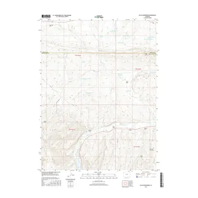
2016 Map of Cactus Reservoir
USGS Topo · Published 2016About this map
The White River winds through this high desert landscape of Rio Blanco County, where the topography is defined by a complex network of dry washes and small irrigation impoundments. The terrain is deeply incised by draws and gulches, including Rock Wall Draw, Chase Draw, and Scullion Gulch, illustrating the arid conditions of the region north of the river. Industrial activity is indicated by Deserado Mine Rd crossing the southern portion of the Moffat and Rio Blanco county line.
Find a feature on this map
32 named features on this map. Tap any name to fly to it.
Don’t see what you’re looking for? This feature index may not catch every label — zoom into the map to look around manually.
Map Details
Editions of this 2016 Cactus Reservoir Map
This is the sole edition of this map. No revisions or reprints were ever made.
Other maps of this area

1907 · Rangely
USGS Topo · 1:125,000

1910 · Rangely
USGS Topo · 1:125,000

1954 · Vernal
USGS Topo · 1:250,000

1958 · Vernal
USGS Topo · 1:250,000

1960 · Vernal
USGS Topo · 1:250,000

1962 · Lazy Y Point
USGS Topo · 1:24,000

1962 · Rangely NE
USGS Topo · 1:24,000
1962 · Rangely
USGS Topo · 1:24,000

1962 · Cactus Reservoir
USGS Topo · 1:24,000
1962 · Calamity Ridge
USGS Topo · 1:24,000