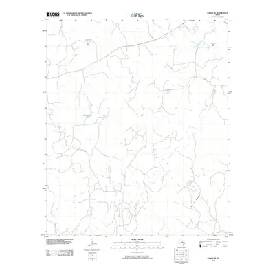
2010 Map of Caddo NE
USGS Topo · Published 2010About this map
The Palo Pinto Mountains anchor the southeastern corner of this North Texas quadrangle, where the landscape is defined by the winding drainage systems of Ioni Creek and Little Caddo Creek. By 2010, the rural topography of this Palo Pinto County area was marked by a network of local roads such as Hart Lane Rd and Hohhertz Rd, which navigate the elevation changes between small reservoirs and watering holes. Significant local water features including Kelly Lake and Lone Star Lake are held by their respective structures, the Kelly Lake Dam and Lone Star Lake Dam. The presence of smaller features like Mud Spring Tank and Cedar Spring Tank illustrates the ranching or agricultural infrastructure common in this part of Texas, showing how water is managed across the varying terrain of the Massey Branch watershed.
Find a feature on this map
17 named features on this map. Tap any name to fly to it.
Don’t see what you’re looking for? This feature index may not catch every label — zoom into the map to look around manually.
Map Details
Editions of this 2010 Caddo NE Map
This is the sole edition of this map. No revisions or reprints were ever made.
Other maps of this area

1890 · Breckenridge
USGS Topo · 1:125,000

1891 · Palo Pinto
USGS Topo · 1:125,000

1918 · Palo Pinto
USGS Topo · 1:125,000

1924 · Palo Pinto 2-c
USGS Topo · 1:48,000

1924 · Breckenridge 1-d
USGS Topo · 1:48,000

1927 · Pickwick
USGS Topo · 1:62,500

1931 · Ivan
USGS Topo · 1:62,500

1954 · Abilene
USGS Topo · 1:250,000

1958 · Abilene
USGS Topo · 1:250,000

1958 · Palo Pinto
USGS Topo · 1:62,500