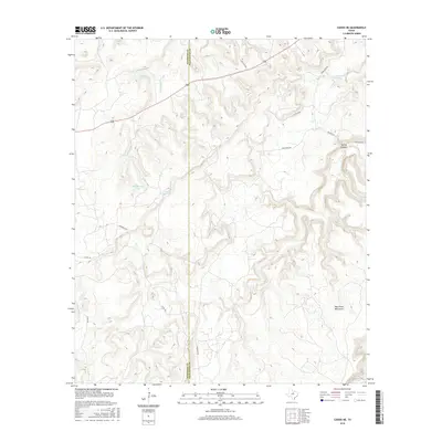
2016 Map of Caddo NE
USGS Topo · Published 2016About this map
The Palo Pinto Mountains dominate this landscape along the border of Stephens and Palo Pinto counties. Water management is a primary feature of the area, as seen in the distribution of ranching and irrigation infrastructure such as Mud Spring Tank and Cedar Spring Tank. The drainage patterns are clearly defined by Little Caddo Cr, Ioni Cr, and Massey Br, while man-made bodies of water like Kelly Lake and Lone Star Lake provide essential resources in this dry terrain. A network of rural routes, including Hart Lane Rd, Scolfield Rd, and Upper Brad Rd, connect the high ridges and deep draws of the North Texas hill country.
Find a feature on this map
18 named features on this map. Tap any name to fly to it.
Don’t see what you’re looking for? This feature index may not catch every label — zoom into the map to look around manually.
Map Details
Editions of this 2016 Caddo NE Map
This is the sole edition of this map. No revisions or reprints were ever made.
Other maps of this area

1890 · Breckenridge
USGS Topo · 1:125,000

1891 · Palo Pinto
USGS Topo · 1:125,000

1918 · Palo Pinto
USGS Topo · 1:125,000

1924 · Palo Pinto 2-c
USGS Topo · 1:48,000

1924 · Breckenridge 1-d
USGS Topo · 1:48,000

1927 · Pickwick
USGS Topo · 1:62,500

1931 · Ivan
USGS Topo · 1:62,500

1954 · Abilene
USGS Topo · 1:250,000

1958 · Abilene
USGS Topo · 1:250,000

1958 · Palo Pinto
USGS Topo · 1:62,500