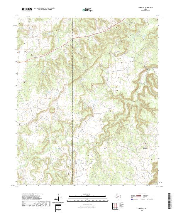
2022 Map of Caddo NE
USGS Topo · Published 2022About this map
The Palo Pinto Mountains anchor the landscape on this modern topographical study, revealing the complex drainage patterns of North Central Texas. The boundary between Stephens County and Palo Pinto County bisects the terrain, which is defined by the headwaters and tributaries of Ioni Cr and Little Caddo Cr. While the region remains sparsely populated, the map tracks a network of rural routes such as Upper Brad Rd and Hohhertz Rd that connect isolated stock tanks and family landholdings.
Find a feature on this map
17 named features on this map. Tap any name to fly to it.
Don’t see what you’re looking for? This feature index may not catch every label — zoom into the map to look around manually.
Map Details
Editions of this 2022 Caddo NE Map
This is the sole edition of this map. No revisions or reprints were ever made.
Other maps of this area

1890 · Breckenridge
USGS Topo · 1:125,000

1891 · Palo Pinto
USGS Topo · 1:125,000

1918 · Palo Pinto
USGS Topo · 1:125,000

1924 · Palo Pinto 2-c
USGS Topo · 1:48,000

1924 · Breckenridge 1-d
USGS Topo · 1:48,000

1927 · Pickwick
USGS Topo · 1:62,500

1931 · Ivan
USGS Topo · 1:62,500

1954 · Abilene
USGS Topo · 1:250,000

1958 · Abilene
USGS Topo · 1:250,000

1958 · Palo Pinto
USGS Topo · 1:62,500