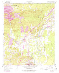
1959 Map of Caddo Valley
USGS Topo · Published 1977About this map
The confluence of the Quachita River and the Caddo River defines this landscape during a period of significant hydroelectric and educational growth. To the northwest, the De Gray Dam and its associated Powerplant illustrate mid-century infrastructure development, while the northern reaches transition into the Montgomery hills and Prairie lands near Friendship. The southern portion of the map is anchored by the dual presence of Henderson State University and Ouachita Baptist University in northern Arkadelphia, marking the area as a prominent regional center for higher education.
Find a feature on this map
33 named features on this map. Tap any name to fly to it.
Don’t see what you’re looking for? This feature index may not catch every label — zoom into the map to look around manually.
Map Details
Editions of this 1959 Caddo Valley Map
3 editions found
Other maps of this area

1948 · Malvern
USGS Topo · 1:62,500

1949 · Malvern
USGS Topo · 1:62,500

1955 · Little Rock
USGS Topo · 1:250,000

1956 · Little Rock
USGS Topo · 1:250,000

1959 · Caddo Valley
USGS Topo · 1:24,000

1959 · Arkadelphia
USGS Topo · 1:24,000

1960 · Little Rock
USGS Topo · 1:250,000

1964 · Little Rock
USGS Topo · 1:250,000

1964 · Donaldson
USGS Topo · 1:24,000
1965 · Dalark
USGS Topo · 1:24,000