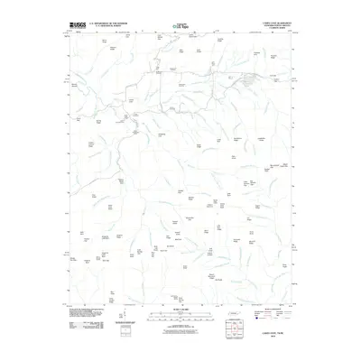
2010 Map of Cades Cove
USGS Topo · Published 2010About this map
Cades Cove remains a preserved landscape of early settlement and agriculture, deeply etched into this Tennessee valley. The map documents the spatial arrangement of legacy homesteads and functional hubs, including the John P Cable Mill Area, the John Oliver Cabin, and the Becky Cable House. These landmarks, along with the Henry Whitehead Cabin, represent the vernacular architecture and farm life of the cove's former inhabitants. The drainage system of Abrams Creek and its many tributaries like Tater Branch and Fanny Branch defined the boundaries of these mountain estates.
Find a feature on this map
148 named features on this map. Tap any name to fly to it.
Don’t see what you’re looking for? This feature index may not catch every label — zoom into the map to look around manually.
Map Details
Editions of this 2010 Cades Cove Map
This is the sole edition of this map. No revisions or reprints were ever made.
Other maps of this area

1886 · Knoxville
USGS Topo · 1:125,000

1892 · Knoxville
USGS Topo · 1:125,000

1894 · Knoxville
USGS Topo · 1:125,000

1895 · Knoxville
USGS Topo · 1:125,000

1901 · Knoxville
USGS Topo · 1:125,000

1933 · Bushnell
USGS Topo · 1:62,500

1935 · Fontana
USGS Topo · 1:24,000

1935 · Calderwood
USGS Topo · 1:24,000
1935 · Tapoco
USGS Topo · 1:24,000
1935 · Blockhouse
USGS Topo · 1:24,000